Northern Virginia Maps
Click on thumbnail images to expand; use browser back button to return to this page
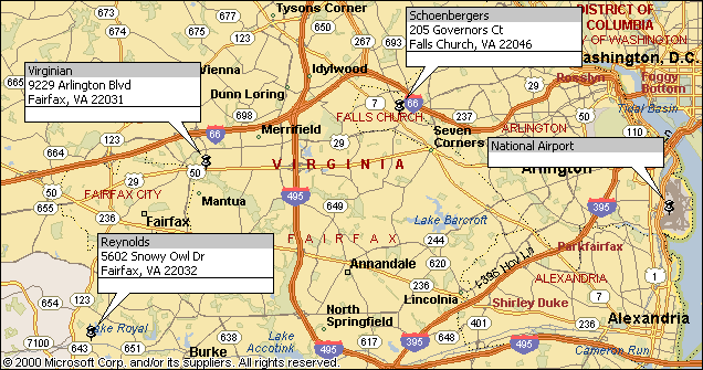
Area map showing National Airport, Virginian, Schoenbergers and Reynolds
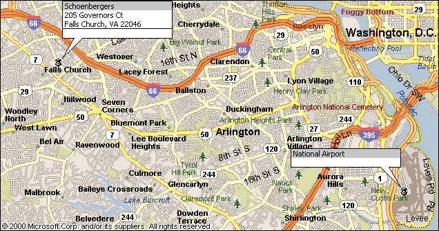
Area Map showing National Airport and Schoenbergers
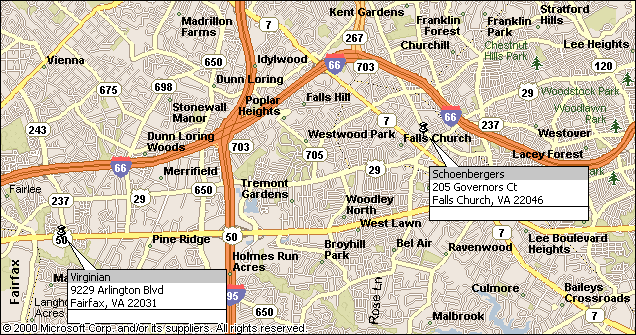
Area Map showing Virginian and Schoenbergers
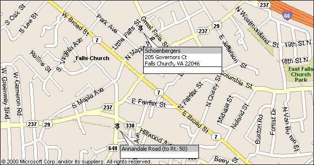
Area Map showing Schoenbergers and Annandale Road (intersects Rt. 50-Arlington Blvd.)
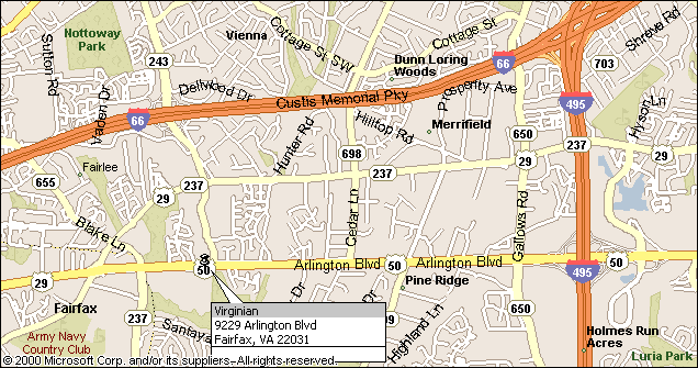
Area Map of the Virginian
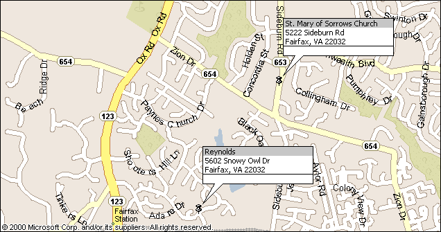
Area Map of the Reynolds and St. Mary of Sorrows Church